
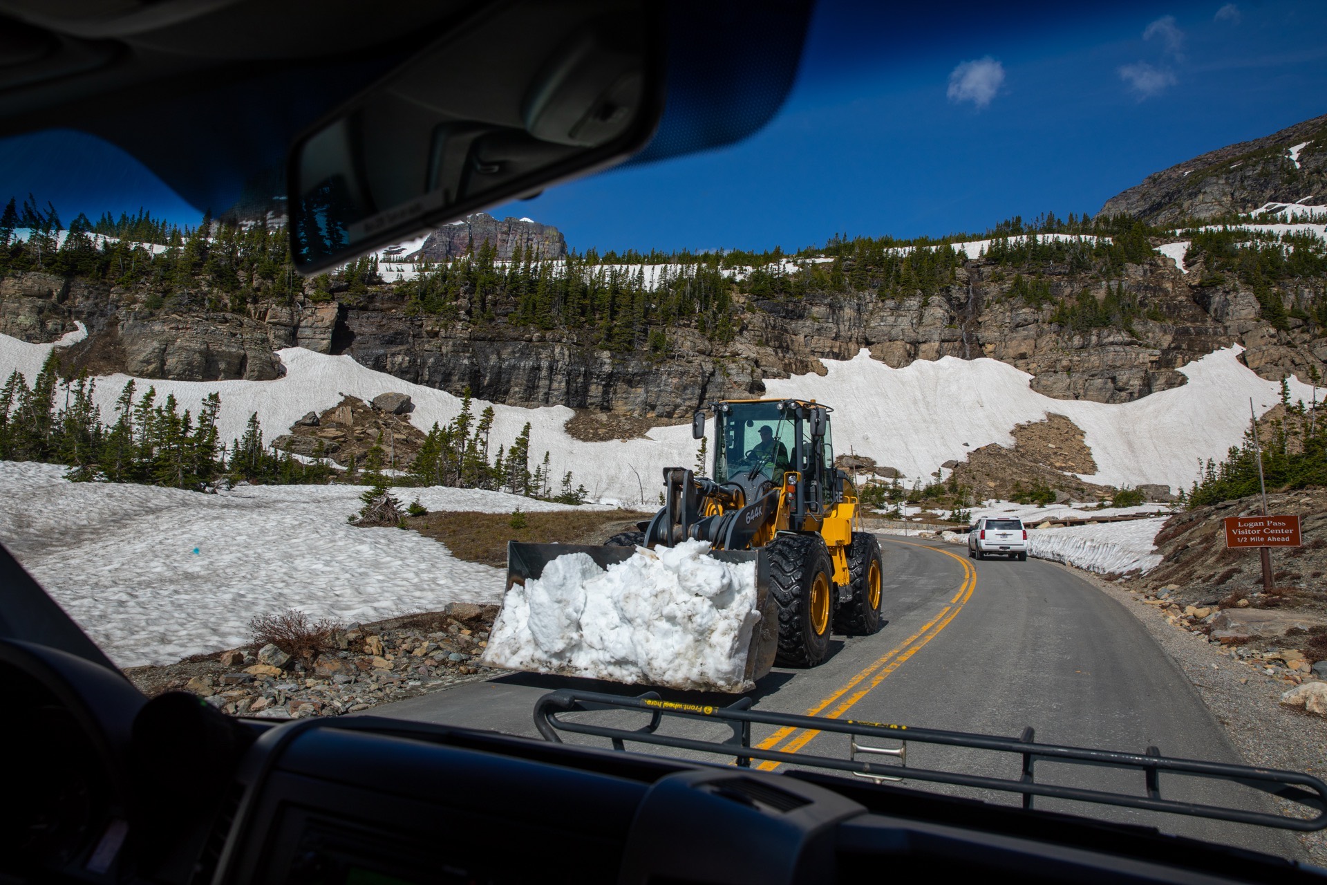
Mountain Pass Closures and Opening Dates
Which mountain passes gate for the winter, how high they are, and when the record says each gate usually closes and reopens.
Across 19 gated roads with a published record, median closing dates run from October 15 to December 16.Find the passes in your state
Enter a ZIP to jump to your state. Colour shows how each road behaves in winter: gated for the season, or kept open under chain control. In Washington you can add the 236 avalanche paths the state highway department has mapped above its own roads, with the slope angle, aspect and vertical fall on each. A mapped path is terrain that has slid before, not a forecast that it will slide today.
70 passes around the western passes. Colour is how the road behaves in winter: gated for the season, or kept open under chain control. Current status is published by the agency linked from each state page.
When the gates usually move
Every row below is a median of what an agency published about its own past seasons, on roads with at least 5 recorded seasons. Two things in this table are worth more than the rest of the page. The first is how wide the spread is on every single road: a two month range around the median is normal, not exceptional. The second is the California result, which surprises almost everybody. The Sierra gates close in the middle of December in the median year, four to six weeks later than the Washington and Colorado gates, because a Sierra gate goes up when a storm arrives rather than when a season does.
The spread matters more than the median. Chinook Pass in Washington has been closing on a published date every year since 1935, 90 seasons of it, and its median closing is November 16. Its earliest is October 19 and its latest is December 18. Ninety years of record buys you a very good sense of when to start paying attention and no ability whatsoever to name the day.
| Road | Median closing | Earliest | Latest | Seasons |
|---|---|---|---|---|
| Old Fall River Road | October 15 | September 8 | December 2 | 44 |
| Going-to-the-Sun Road over Logan Pass | October 21 | September 3 | November 21 | 71 |
| Trail Ridge Road, US 34 | October 29 | October 2 | December 2 | 77 |
| Independence Pass, Colorado Highway 82 | November 4 | October 25 | November 17 | 11 |
| Mammoth Lakes | November 4 | October 15 | November 9 | 7 |
| Lassen park highway, State Route 89 through the park | November 11 | October 18 | December 18 | 46 |
| Tioga Road inside Yosemite, the park half of the Tioga Pass crossing | November 13 | October 17 | January 17 | 46 |
| Glacier Point Road | November 14 | October 31 | December 12 | 27 |
| Lassen Loop | November 15 | October 28 | December 9 | 7 |
| Chinook Pass, State Route 410 | November 16 | October 19 | December 18 | 90 |
| Lake Sabrina to Aspendell | November 16 | November 3 | December 16 | 7 |
| Snowy Range Scenic Byway, Wyoming Highway 130 | November 17 | November 10 | November 26 | 6 |
| Cayuse Pass, State Route 123 | November 24 | October 7 | January 8 | 52 |
| North Cascades Highway, State Route 20, over Rainy and Washington passes | November 24 | October 17 | January 3 | 53 |
| Tioga Pass | November 25 | November 17 | December 19 | 7 |
| Ebbetts Pass | December 16 | November 18 | January 2 | 7 |
| Monitor Pass | December 16 | December 2 | February 18 | 7 |
| Sonora Pass | December 16 | November 18 | January 2 | 7 |
| June Lake Loop | December 16 | November 26 | February 13 | 7 |
A median is arithmetic on the agency’s published numbers for past seasons, not a forecast for this one. Where the record comes from a National Park Service page it is a federal work in the public domain and the table is reproduced; where it comes from a state highway department the dates are restated in our own structure because the agency’s table is its own.
And when they usually reopen
The spring side of the same record, which is the half people ask about most and the half that is least predictable. The spread on an opening date is wider than on a closing date on almost every road here, because closing is a decision and opening is an operation: a crew has to cut a road out of a drift under slopes that are still loaded, and how long that takes is set by how much snow fell.
| Road | Median reopening | Earliest | Latest | Seasons |
|---|---|---|---|---|
| June Lake Loop | March 26 | February 26 | April 27 | 7 |
| Monitor Pass | April 9 | March 5 | May 12 | 7 |
| North Cascades Highway, State Route 20, over Rainy and Washington passes | April 23 | March 10 | September 2 | 54 |
| Lake Sabrina to Aspendell | April 25 | April 15 | June 1 | 7 |
| Cayuse Pass, State Route 123 | May 6 | March 18 | September 29 | 51 |
| Ebbetts Pass | May 12 | May 8 | June 8 | 6 |
| Glacier Point Road | May 15 | March 28 | July 15 | 30 |
| Sonora Pass | May 15 | April 30 | June 9 | 7 |
| Tioga Road inside Yosemite, the park half of the Tioga Pass crossing | May 24 | April 8 | July 22 | 68 |
| Chinook Pass, State Route 410 | May 25 | April 2 | July 12 | 90 |
| Independence Pass, Colorado Highway 82 | May 26 | May 21 | May 31 | 6 |
| Tioga Pass | May 27 | April 15 | July 22 | 7 |
| Trail Ridge Road, US 34 | May 28 | May 7 | July 16 | 78 |
| Lassen park highway, State Route 89 through the park | June 2 | April 28 | July 26 | 47 |
| Lassen Loop | June 3 | April 7 | July 3 | 7 |
| Mammoth Lakes | June 5 | May 28 | July 14 | 6 |
| Going-to-the-Sun Road over Logan Pass | June 11 | May 16 | July 15 | 90 |
| Old Fall River Road | June 30 | May 27 | July 29 | 39 |
The spring half of this question, organised by park rather than by highway, is on park road openings, which covers the campgrounds and visitor centres alongside the roads.
Who reports each pass right now
A gate decision is made by a maintenance supervisor or a park road crew standing at the road, and it can change inside an hour when a storm turns. Each agency below publishes its own passes in real time.
The deepest record in the country, and why its footnotes matter
Glacier National Park has published the opening of Going-to-the-Sun Road over Logan Pass every year since 1933, and the closing as well from 1952. That is 90 seasons with no missing year. It is not the longest record on this site by a season or two, but it is by far the most useful, because the park attaches a lettered footnote to every unusual year explaining what happened, and several of the dates are actively misleading without one.
Glacier National Park, Logan Pass opening and closing dates, footnote (q) on the 2020 row“Late opening due to COVID-19 pandemic. Road open from West Entrance to Rising Sun only. First time in history a portion of the Going-to-the-Sun Road remained closed for an entire season.”
A work of the United States government, in the public domain, so it is reproduced word for word. Read on 4 September 2026.
Reading a record like that as a weather signal, without the footnotes, produces confident nonsense. The 2020 opening is a pandemic. Two of the late 2010s closings are rehabilitation projects on the west side. The 2017 closing is the Sprague Fire. And from 1992 the closing date stopped being a weather decision at all and became a rule: the park fixed it to the third Monday in October, weather permitting, which flattens the spread of every closing after that year. This site prints the footnote next to the date rather than the date alone.
| Season | Opened | Closed | What happened |
|---|---|---|---|
| 2022 | Jul 13 | Oct 16 | Exceptional avalanche year and continued winter weather through late June. West side closure Oct 1 for road rehabilitation work, a multi-year project. Logan Pass accessible from east side through Oct. 16. |
| 2021 | Jun 25 | Oct 13 | |
| 2020 | Jul 13 | Oct 9 | Late opening due to COVID-19 pandemic. Road open from West Entrance to Rising Sun only. First time in history a portion of the Going-to-the-Sun Road remained closed for an entire season. |
| 2019 | Jun 22 | Sep 25 | |
| 2018 | Jun 22 | Sep 29 | |
| 2017 | Jun 28 | Sep 3 | Closure on west side due to Sprague Fire and subsequent road construction work. Logan Pass accessible from east side through Oct. 9. |
| 2016 | Jun 16 | Oct 10 | |
| 2015 | Jun 19 | Oct 5 | The road opened on the west side to Logan Pass on June 10, but the road did not fully open until June 19. East side closure for road rehabilitation work, a multi-year project. Logan Pass accessible from west side through Oct. 19. |
| 2014 | Jul 2 | Sep 22 | East side closure for road rehabilitation work, a multi-year project. Logan Pass accessible from west side through Oct. 20. |
| 2013 | Jun 21 | Sep 23 | Opened June 15 on east side from St. Mary to Logan Pass. Later opening on west side due to road rehabilitation work and snowstorms. Closed due to government shutdown. |
| 2012 | Jun 19 | Sep 16 | West side closure for road rehabilitation work, a multi-year project; Logan Pass accessible from east side through Oct. 15. |
| 2011 | Jul 13 | Sep 17 | Exceptional snowpack year and continued winter weather through June. West side closure for road rehabilitation work, a multi-year project; Logan Pass accessible from east side through Oct. 17. |
| 2010 | Jun 24 | Oct 18 | |
| 2009 | Jun 26 | Oct 19 | |
| 2008 | Jul 2 | Oct 20 | |
| 2007 | Jul 1 | Sep 16 | |
| 2006 | Jun 23 | Oct 23 | |
| 2005 | May 22 | Oct 31 | |
| 2004 | May 30 | Oct 18 | |
| 2003 | May 30 | Oct 28 | |
| 2002 | Jun 28 | Oct 28 | |
| 2001 | Jun 7 | Oct 22 | |
| 2000 | May 27 | Oct 16 | |
| 1999 | Jun 16 | Oct 15 |
Showing the most recent 24 of 90 recorded seasons. The full record is published by the agency at the link below.
Federal record: National Park Service, Glacier National Park, carrying its own stamp of last updated April 21, 2023. Public domain, so it may be reproduced. Read on 4 September 2026.
Three cells in the federal Yosemite dataset are corrected here
The National Park Service dataset behind the Tioga Road record is live, and three of its cells cannot be right. Two independent sources agree against it on all three: archived captures of the same dataset, and the Mono Lake Committee’s own compilation, which is a private copyrighted work used here only as evidence that a cell is wrong and named for that reason. Every corrected cell is marked in the table above.
- 1996. The National Park Service dataset reads May 13 for the 1996 Tioga opening. Archived captures of the same dataset and the Mono Lake Committee series both give May 31, and 13 looks like a transposition of 31.
- 2010. The National Park Service dataset reads Jan 17 for the 2010 Tioga closing. The closing column is shifted one row upward here: the correct 2010 value is November 19, and Jan 17 belongs to the following season.
- 2011. The National Park Service dataset reads Dec 31 for the 2011 Tioga closing. The correct value is 17 January 2012, the latest Tioga closing on record, which is the value the shifted column had written on the 2010 row.
A pass that closes and a pass that needs chains are different roads
This is the distinction that most writing on the subject loses, and losing it is how a driver ends up at a gate that has been shut since November holding an article about traction requirements. 36 of the 70 passes on this site shut entirely for the winter, so the answer in January is that there is no road and the useful question is when the gate usually moves. 34 of them are maintained all winter, so there is no seasonal date at all and what varies is whether you need chains, whether a control shot has the road held, and whether a storm has closed it for the afternoon.
Snoqualmie Pass, Wolf Creek Pass, Teton Pass and Togwotee Pass are all in that second group and all four are routinely described as seasonal closures. They are not. Sherman Pass in Washington is the sharpest version of the trap: it is the highest pass in the state kept open year round, and it shares a route number with the North Cascades Highway, which closes every winter. Anything that keys on the route number rather than the pass name will eventually tell you the wrong one.
Seasonal gate
the road shuts entirely for the winter behind a physical gate, so the useful questions are when it usually shuts and when it usually reopens
23 on this site
Park road gate
the same seasonal gate, but operated by the National Park Service rather than a state highway department, which changes who publishes the answer and often changes the date
10 on this site
Open all winter
the road is maintained through the winter and what varies is traction requirements, avalanche control holds and storm closures, so there is no seasonal date to give
34 on this site
County road gate
gated for the winter but maintained by a county rather than the state, which is why the state highway department publishes nothing about it at all
3 on this site
The full inventory
| Pass | Route | Elevation | Winter behaviour | Snow station on it |
|---|---|---|---|---|
| Mount Blue Sky | SR 5 | 14,130 ft | Seasonal gate closes for winter | none |
| Trail Ridge Road | US 34 | 12,183 ft | Park road gate closes for winter, run by a park | none |
| Cottonwood Pass | CR 306 and CR 209 | 12,126 ft | County road gate closes for winter, run by a county | none |
| Independence Pass | CO 82 | 12,095 ft | Seasonal gate closes for winter | Independence Pass, 10,570 ft |
| Loveland Pass | US 6 | 11,991 ft | Open all winter stays open, chains or traction may be required | none |
| Old Fall River Road | inside Rocky Mountain NP | 11,796 ft | Park road gate closes for winter, run by a park | none |
| Guanella Pass | CR 381 | 11,669 ft | County road gate closes for winter, run by a county | none |
| Hoosier Pass | SR 9 | 11,542 ft | Open all winter stays open, chains or traction may be required | Hoosier Pass, 11,600 ft |
| Monarch Pass | US 50 | 11,312 ft | Open all winter stays open, chains or traction may be required | none |
| Berthoud Pass | US 40 | 11,307 ft | Open all winter stays open, chains or traction may be required | Berthoud Summit, 11,300 ft |
| Red Mountain Pass | US 550 | 11,018 ft | Open all winter stays open, chains or traction may be required | Red Mountain Pass, 11,060 ft |
| Beartooth Highway | US 212 | 10,947 ft | Seasonal gate closes for winter | none |
| Wolf Creek Pass | US 160 | 10,857 ft | Open all winter stays open, chains or traction may be required | Wolf Creek Summit, 10,930 ft |
| Snowy Range Scenic Byway | WYO 130 | 10,847 ft | Seasonal gate closes for winter | none |
| Mirror Lake Highway | SR 150 | 10,715 ft | Seasonal gate closes for winter | none |
| Vail Pass | I-70 | 10,662 ft | Open all winter stays open, chains or traction may be required | none |
| Cedar Breaks, State Route 148 | SR 148 | 10,350 ft | Park road gate closes for winter, run by a park | none |
| Lizard Head Pass | SR 145 | 10,222 ft | Open all winter stays open, chains or traction may be required | Lizard Head Pass, 10,190 ft |
| Kebler Pass | CR 12 | 9,980 ft | County road gate closes for winter, run by a county | none |
| Tioga Road | inside Yosemite | 9,945 ft | Park road gate closes for winter, run by a park | none |
| Tioga Pass, State Route 120 east of the park | SR 120 | 9,937 ft | Seasonal gate closes for winter | none |
| Guardsman Pass | SR 190 and SR 224 | 9,709 ft | Seasonal gate closes for winter | none |
| Powder River Pass | US 16 | 9,666 ft | Open all winter stays open, chains or traction may be required | Powder River Pass, 9,480 ft |
| Togwotee Pass | US 26 and 287 | 9,658 ft | Open all winter stays open, chains or traction may be required | Togwotee Pass, 9,590 ft |
| Sonora Pass | SR 108 | 9,624 ft | Seasonal gate closes for winter | Sonora Pass, 8,770 ft |
| Wolf Creek Summit | SR 35 | 9,485 ft | Seasonal gate closes for winter | none |
| Rabbit Ears Pass | US 40 | 9,426 ft | Open all winter stays open, chains or traction may be required | none |
| Monte Cristo | SR 39 | 9,148 ft | Seasonal gate closes for winter | none |
| Lake Sabrina to Aspendell | SR 168 | 9,128 ft | Seasonal gate closes for winter | none |
| Mammoth Lakes Basin and Reds Meadow | SR 203 | 8,973 ft | Seasonal gate closes for winter | none |
| Dunraven Pass | Grand Loop Road | 8,878 ft | Park road gate closes for winter, run by a park | none |
| Ebbetts Pass | SR 4 | 8,730 ft | Seasonal gate closes for winter | Ebbetts Pass, 8,660 ft |
| Carson Pass | SR 88 | 8,574 ft | Open all winter stays open, chains or traction may be required | Carson Pass, 8,360 ft |
| Sylvan Pass | US 14, 16 and 20 | 8,524 ft | Park road gate closes for winter, run by a park | none |
| Lassen park highway | SR 89 | 8,512 ft | Park road gate closes for winter, run by a park | none |
| Lassen Loop, the Caltrans half of SR 89 | SR 89 | 8,512 ft | Seasonal gate closes for winter | none |
| Onyx Summit | SR 38 | 8,443 ft | Open all winter stays open, chains or traction may be required | none |
| Teton Pass | WYO 22 | 8,431 ft | Open all winter stays open, chains or traction may be required | none |
| Monitor Pass | SR 89 | 8,314 ft | Seasonal gate closes for winter | Monitor Pass, 8,320 ft |
| Craig Pass | Grand Loop Road | 8,262 ft | Park road gate closes for winter, run by a park | none |
| Alpine Loop | SR 92 | 8,020 ft | Seasonal gate closes for winter | Timpanogos Divide, 8,180 ft |
| Angeles Crest Highway | SR 2 | 7,903 ft | Seasonal gate closes for winter | none |
| East Canyon | SR 65 | 7,420 ft | Seasonal gate closes for winter | none |
| South Pass | WYO 28 | 7,412 ft | Open all winter stays open, chains or traction may be required | South Pass, 9,040 ft |
| Echo Summit | US 50 | 7,401 ft | Open all winter stays open, chains or traction may be required | none |
| Donner Summit | I-80 | 7,239 ft | Open all winter stays open, chains or traction may be required | none |
| June Lake Loop | SR 158 | 7,234 ft | Seasonal gate closes for winter | none |
| Glacier Point Road | inside Yosemite | 7,214 ft | Park road gate closes for winter, run by a park | none |
| Parleys Summit | I-80 | 7,020 ft | Open all winter stays open, chains or traction may be required | Parleys Summit, 7,590 ft |
| Badger Pass | no through road | 6,870 ft | Open all winter stays open, chains or traction may be required | Badger Pass, 6,870 ft |
| Going-to-the-Sun Road over Logan Pass | inside Glacier NP | 6,646 ft | Park road gate closes for winter, run by a park | none |
| Cedar Pass | SR 299 | 6,305 ft | Open all winter stays open, chains or traction may be required | Cedar Pass, 7,060 ft |
| Sherman Pass | SR 20 | 5,575 ft | Open all winter stays open, chains or traction may be required | none |
| North Cascades Highway | SR 20 | 5,477 ft | Seasonal gate closes for winter | Rainy Pass, 4,880 ft |
| Chinook Pass | SR 410 | 5,430 ft | Seasonal gate closes for winter | none |
| Lolo Pass | US 12 | 5,233 ft | Open all winter stays open, chains or traction may be required | Lolo Pass, 5,280 ft |
| Cayuse Pass | SR 123 | 4,675 ft | Seasonal gate closes for winter | Cayuse Pass, 5,260 ft |
| White Pass | US 12 | 4,500 ft | Open all winter stays open, chains or traction may be required | White Pass E.S., 4,440 ft |
| Wauconda Pass | SR 20 | 4,310 ft | Open all winter stays open, chains or traction may be required | none |
| Mount Baker Highway to Artist Point | SR 542 | 4,250 ft | Seasonal gate closes for winter | none |
| Tejon Pass, the Grapevine | I-5 | 4,144 ft | Open all winter stays open, chains or traction may be required | none |
| Blewett Pass | US 97 | 4,102 ft | Open all winter stays open, chains or traction may be required | Blewett Pass, 4,240 ft |
| Stevens Pass | US 2 | 4,061 ft | Open all winter stays open, chains or traction may be required | Stevens Pass, 3,940 ft |
| Loup Loup Pass | SR 20 | 4,020 ft | Open all winter stays open, chains or traction may be required | none |
| Disautel Pass | SR 155 | 3,252 ft | Open all winter stays open, chains or traction may be required | none |
| Satus Pass | US 97 | 3,107 ft | Open all winter stays open, chains or traction may be required | Satus Pass, 3,960 ft |
| Snoqualmie Pass | I-90 | 3,022 ft | Open all winter stays open, chains or traction may be required | Stampede Pass, 3,850 ft |
| Manastash Ridge | I-82 | 2,672 ft | Open all winter stays open, chains or traction may be required | none |
| Crystal to Greenwater | SR 410 | 2,600 ft | Open all winter stays open, chains or traction may be required | none |
| Tiger Mountain | SR 18 | 1,377 ft | Open all winter stays open, chains or traction may be required | none |
The six states with a page
A state has a page here when it has either a published record of its gate dates or a live pass feed a browser can read without a key. Six states clear that bar; the other forty four are named below, each with its reason.
The gap is not in the flat states. Colorado, Wyoming, Montana, Utah, Nevada, Oregon, Idaho and Alaska all have real seasonal gates on real mountain highways, and their highway departments publish road conditions through keyed systems or not in machine readable form at all. Six of those eight have a page on the strength of a national park record or the dates an agency prints inside its own press releases. Nevada and Oregon have neither a published record nor a keyless feed; current status for their passes is on each highway department’s own traveller information site.
States with a page
Washington
North Cascades Highway, 5,477 ft
Live WSDOT reading on the page
California
Tioga Road, 9,945 ft
Live Caltrans reading on the page
Colorado
Trail Ridge Road, 12,183 ft
Road status from the agency; snowpack and weather read live
Montana
Going-to-the-Sun Road over Logan Pass, 6,646 ft
Road status from the agency; snowpack and weather read live
Wyoming
Snowy Range Scenic Byway, 10,847 ft
Road status from the agency; snowpack and weather read live
Utah
Mirror Lake Highway, 10,715 ft
Road status from the agency; snowpack and weather read live
States without a page
- Alabama
- No highway in Alabama crosses a mountain pass that closes for the season, and no state agency publishes a pass condition report.
- Alaska
- Alaska has real mountain passes, including Atigun Pass on the Dalton Highway at 4,780 feet, but its 511 system is keyed and no year by year opening record is published for any of them; current status is on Alaska 511.
- Arizona
- Arizona has high country roads that close in storms, but no state highway gate with a published seasonal date, and the state publishes no keyless pass condition feed.
- Arkansas
- The Ozark and Ouachita highways ice over and close in storms, but none is gated for the season, so there is no opening or closing date to publish.
- Connecticut
- No seasonally gated mountain highway. The highest point in Connecticut is below the elevation at which any road in America gates for snow.
- Delaware
- The highest point in Delaware is 448 feet. There is no mountain pass, no seasonal road gate and no state pass condition report.
- Florida
- No mountain passes, no seasonal snow gates, and no state road condition feed that would report one if there were.
- Georgia
- The Blue Ridge highways close in ice storms but are not seasonally gated, and Georgia publishes no pass opening or closing record.
- Hawaii
- The Mauna Kea access road closes for weather, sometimes for snow, but it is not a seasonal gate and no year by year record is published for it.
- Idaho
- Idaho has genuine mountain passes and its highway department maps 240 winter reporting segments, but every one of them carries no condition value in the public feed and the 511 system needs a key, so there is nothing live to read and no published date record.
- Illinois
- No mountain passes and no seasonally gated highway. The highest point in Illinois is 1,235 feet and nothing in the state is gated for snow.
- Indiana
- No mountain passes and no seasonally gated highway. Indiana closes roads for blizzards and flooding, neither of which is a seasonal gate.
- Iowa
- Iowa gates interstate ramps for blizzards, which is a genuine winter closure system, but it is not a mountain pass and belongs to a different question than this one.
- Kansas
- No mountain passes. Kansas closes highways for ground blizzards, which is a storm event lasting hours rather than a seasonal gate.
- Kentucky
- The Appalachian gaps carry highways that ice over in winter storms, but none of them is gated for the season and no record of one is published.
- Louisiana
- No mountain passes and no seasonal road gates. The highest point in Louisiana is 535 feet and nothing there closes for snow.
- Maine
- Maine has mountain roads that close for the winter inside Baxter State Park and Acadia, but no state highway pass with a published seasonal record.
- Maryland
- The Allegheny highways in Garrett County get the heaviest snow in the state, and none of them is a seasonally gated pass.
- Massachusetts
- The Mount Greylock summit road closes for the winter, but it is a park road with no published year by year record rather than a highway pass.
- Michigan
- No mountain passes. The Upper Peninsula snow belt is covered by the lake effect snow pages, which answer a different question than this one.
- Minnesota
- No mountain passes and no seasonally gated highway. The North Shore highways carry deep snow and are plowed all winter rather than gated.
- Mississippi
- No mountain passes and no seasonal road gates. The highest point in Mississippi is 807 feet and nothing there closes for snow.
- Missouri
- No mountain passes and no seasonally gated highway. The Ozark ridge roads ice over and are maintained through the winter rather than closed.
- Nebraska
- No mountain passes. Nebraska closes interstates for ground blizzards, which is a storm event lasting hours rather than a seasonal gate.
- Nevada
- Nevada has high desert passes on US 50 and elsewhere, but no seasonal gate with a published record and no keyless road condition feed: its 511 system rejects requests without a key and no public GIS layer carries a condition value.
- New Hampshire
- The Mount Washington Auto Road closes for the winter but is privately operated, and no state highway in New Hampshire is a seasonally gated pass.
- New Jersey
- No mountain passes and no seasonally gated highway. The Kittatinny ridge roads are plowed through the winter rather than gated.
- New Mexico
- New Mexico has high passes on the Enchanted Circle and elsewhere, but none is seasonally gated with a published date record, and its work zone feed is dead.
- New York
- The Whiteface Veterans Memorial Highway closes for the winter, but it is a toll road operated by a state authority with no published year by year record, and no New York highway pass is gated.
- North Carolina
- The Blue Ridge Parkway closes in sections all winter, which is a real seasonal closure, but the National Park Service publishes it as a live map rather than as a date record, and no median can be taken from a map.
- North Dakota
- No mountain passes. North Dakota closes highways for ground blizzards, which is a storm event lasting hours rather than a seasonal gate.
- Ohio
- No mountain passes and no seasonally gated highway. Ohio closes roads for lake effect whiteouts, which is a storm event rather than a season.
- Oklahoma
- No mountain passes and no seasonally gated highway. The Ouachita and Wichita ranges carry no road that closes for the winter.
- Oregon
- Oregon has two famous seasonal gates, the McKenzie Pass highway and the Crater Lake rim road, and neither gate has a published year by year record; current status for both is on the Oregon Department of Transportation traveller information site.
- Pennsylvania
- The Alleghenies carry heavy snow and steep grades, and no Pennsylvania highway is a seasonally gated pass with a published record.
- Rhode Island
- No mountain passes and no seasonally gated highway. The highest point in Rhode Island is 812 feet and no road there is gated for snow.
- South Carolina
- No mountain passes and no seasonally gated highway. The Blue Ridge escarpment roads ice in storms and are not seasonally closed.
- South Dakota
- The Black Hills carry Iron Mountain Road and the Needles Highway, which close for the winter, but the state publishes no year by year record for either.
- Tennessee
- Newfound Gap and Clingmans Dome Road close for weather and for the season, but the National Park Service publishes them as a live status rather than as a date record.
- Texas
- No seasonally gated mountain passes. The Guadalupe Mountains highway closes in storms, which is a storm event rather than a season.
- Vermont
- Smugglers Notch on Route 108 and the Lincoln Gap road close every winter, and both are genuine seasonal gates, but Vermont publishes no year by year record for either and no keyless condition feed.
- Virginia
- The Blue Ridge Parkway sections in Virginia close all winter, but as a live National Park Service map rather than a published date record.
- West Virginia
- The Highland Scenic Highway closes for the winter, but no year by year record is published and the state has no keyless pass feed.
- Wisconsin
- No mountain passes and no seasonally gated highway. Wisconsin snow belt roads are covered by the lake effect snow pages rather than by this one.
Mountain pass FAQ
Related conditions
Historic dates come from the publishers named beside each table and were read on 4 September 2026. National Park Service material is a United States government work in the public domain and is reproduced; state highway department material is not, so their dates are restated in our own structure and their sentences are not copied. Live chain control comes from Caltrans, live pass reports from WSDOT, measured snow depth from USDA NRCS SNOTEL, and weather products from api.weather.gov. 25 of the passes here have a snow station named after them and sited on them, which is the only reason a measured depth appears beside a road at all.
Gate status is published by the agencies linked above. The dates here are records of past seasons, not predictions.
Hero image: “Snowplows at Logan Pass (52201734565)” — GlacierNPS — Public domain