
Skip to content

Colorado Mountain Passes

Every Colorado pass worth naming, how high it is, whether it gates for the winter or stays open, what the record says about when the gate moves, and the agency that publishes today's status.

In the seasons the agencies have published, Trail Ridge Road has closed around October 29. That is a median of past seasons; today's status is with the agency linked below.
Passes on this page
16
Gated for winter
7
With a published record
3
With a snow station on them
6
Current status

Where Colorado pass status is published

Check the agency below before you drive. Gate decisions are made by highway crews and park rangers looking at the road, and they change inside a day.

Colorado is the largest gap between how much people want this answer and how much of it is published. It has the highest paved through road in the country and some of the most consequential winter highways anywhere, and its highway department publishes its live data through a keyed system, so the live readings on this page are snowpack and weather rather than the road itself. What Colorado does have is Trail Ridge Road, whose National Park Service record is the longest on this site, and a highway department that prints its own past ten closing dates inside every Independence Pass closure release. Everything else here is snowpack, weather and a pointer.

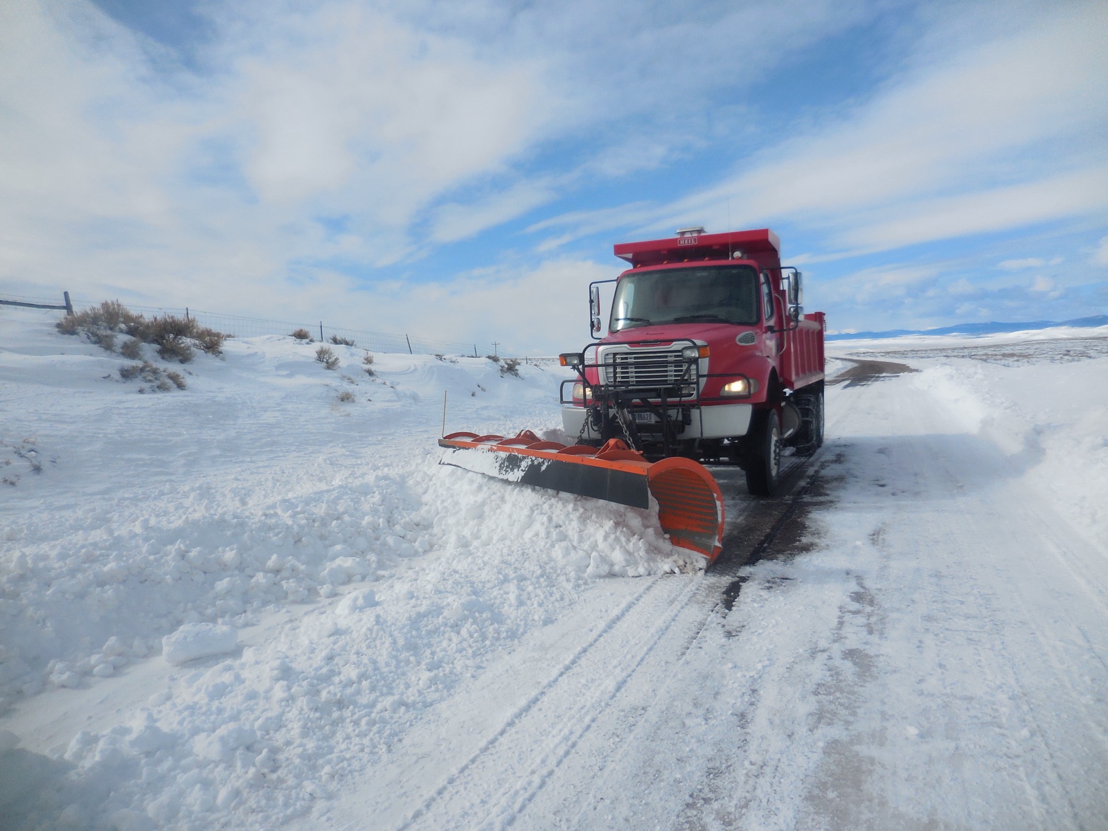
A highway snowplow throwing a wall of snow off the shoulder of a two lane mountain road
The reason a gate date is not a calendar date. Reopening a gated pass is not a matter of waiting for a thaw: a crew drives a rotary blower into drifts that can stand thirty feet above the pavement, and they do it under slopes that are still loaded. That is why the same road can open on 2 April in one year and 22 July in another, and why no agency on this page will name a date in advance. “Snow Plowing Jones Hole Highway (51313598806)” — USFWS Mountain Prairie — Public domain
Measured right now

What instruments are reading on the Colorado passes

Check the agency below before you drive. Gate decisions are made by highway crews and park rangers looking at the road, and they change inside a day.

Colorado Department of Transportation publishes its road conditions through a keyed system, so this page reads no live Colorado road feed. What it reads live is federal: measured snowpack from the USDA network, and National Weather Service products for the state. For the road itself, COtrip is the source and the pointer above is the link.

Our own summary of information published by Colorado Department of Transportation. A state agency’s words are its own, so this is a restatement of the facts rather than a copy of the page.

Measured snow on the passes

Reading measured snow depth from SNOTEL.

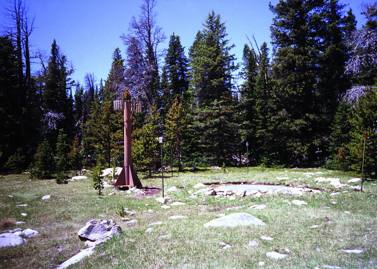
A SNOTEL weather station in a forest clearing, a tall mast and instrument shelter standing over an open patch of snow
A SNOTEL station: a sonic ranger on the mast measuring the distance down to the snow surface, and a fluid filled pillow buried under the pack weighing the water in it. That second number is the one that matters to a plow crew, because two feet of dry January powder and two feet of April corn are not the same job. Note also what the picture shows: a clearing in trees, not a roadway. This is why every depth on this page carries its station name and elevation. “Cloud Peak SNOTEL site in Montana” — USDA Natural Resources Conservation Service — Public Domain

National Weather Service winter products for Colorado

Twenty of the National Weather Service’s one hundred and eleven product types are winter or road relevant, from a Winter Weather Advisory to a Snow Squall Warning to an Avalanche Warning. They are federal works in the public domain, which is why this is the one place on the page where somebody else’s live sentences appear word for word rather than in our own.

Reading National Weather Service products for Colorado.

The forecast at one pass

A forecast for a valley town is not a forecast for the pass above it. Pick a pass and this reads the National Weather Service grid at that pass’s own coordinates, one pass at a time.

Advertisement
The map

Every Colorado pass on one map

Colour is winter behaviour: a purple or teal marker is a road with a gate that shuts for the season, and a dark marker is a road kept open all winter where what changes is the traction requirement. Enter a ZIP and the map moves to your state and names the county it matched, a county level match from the Census relationship file.

Style
Area
Size

16 passes around Colorado. Colour is how the road behaves in winter: gated for the season, or kept open under chain control. Current status is published by the agency linked from each state page.

The record

What the published record says about the Colorado gates

Check the agency below before you drive. Gate decisions are made by highway crews and park rangers looking at the road, and they change inside a day.

Trail Ridge Road

US 34, 12,183 feet. The highest continuous paved road in the United States, topping out at 12,183 feet, and the longest record on this site: an unbroken published run of openings and closings since 1932.

Closing dates across 77 recorded seasons from 1932 to 2008

Median October 29. Earliest October 2 in 1951. Latest December 2 in 1933. That is a spread of 61 days, which is the number that matters more than the median does.

Reopening dates across 78 recorded seasons from 1932 to 2009

Median May 28. Earliest May 7 in 2002. Latest July 16 in 1932. That is a spread of 70 days, which is the number that matters more than the median does.

Trail Ridge Road, US 34. The gate is the alpine section between Many Parks Curve and the Colorado River trailhead.
SeasonOpenedClosed
2009May 21not published
2008May 23Nov 6
2007May 25Oct 22
2006May 24Oct 23 (not open after Oct 16)
2005May 21Nov 4 (not open after Oct 28)
2004May 20Oct 25 (not open after Oct 12)
2003May 23Nov 6 (not open after Nov 1)
2002May 7Nov 1 (not open after Oct 22)
2001May 25Oct 18 (not open after Oct 10)
2000May 23Nov 2 (not open after Oct 24)
1999May 28Nov 22 (not open after Nov 18)
1998May 29Oct 26
1997May 28Oct 22
1996May 31Oct 21 (not open after Oct 18)
1995May 27Oct 27
1994Jun 4Oct 29 (not open after Oct 18)
1993May 29Oct 28
1992May 30Nov 1 (not open after Oct 30)
1991May 25Nov 2 (not open after Oct 18)
1990May 28Oct 16
1989May 27Oct 18
1988May 28Nov 7 (not open after Nov 2)
1987May 16Nov 12 (not open after Nov 5)
1986May 24Oct 28 (not open after Oct 24)
1985May 24Oct 11 (not open after Oct 7)
1984May 26Oct 19 (not open after Oct 13)
1983Jun 5Nov 9 (not open after Nov 5)
1982May 28Nov 2 (not open after Oct 25)
1981May 23Oct 29 (not open after Oct 12)
1980May 29Oct 27 (not open after Oct 13)
1979May 27Nov 13 (not open after Oct 29)
1978Jun 2Oct 30 (not open after Oct 22)
1977May 13Nov 11 (not open after Nov 8)
1976May 18Nov 26 (not open after Nov 25)
1975May 27Oct 31 (not open after Oct 22)
1974May 25Oct 30 (not open after Oct 28)
1973Jun 6Nov 2 (not open after Oct 29)
1972May 19Oct 27
1971May 28Oct 20 (not open after Oct 17)
1970May 23Oct 16 (not open after Oct 6)

Showing the most recent 40 of 78 recorded seasons. The full record is published by the agency at the link below.

Federal record: National Park Service, Rocky Mountain National Park, carrying its own stamp of last updated February 24, 2015. Public domain, so it may be reproduced. Read on 4 September 2026.
Old Fall River Road

inside Rocky Mountain NP, 11,796 feet. One way, gravel, and eleven miles from Endovalley to the Alpine Visitor Center. Its record has a hole in it: the park states plainly that no records are available between 1939 and 1984, and the table shows that gap.

Closing dates across 44 recorded seasons from 1922 to 2009

Median October 15. Earliest September 8 in 1985. Latest December 2 in 1933. That is a spread of 85 days, which is the number that matters more than the median does.

Reopening dates across 39 recorded seasons from 1921 to 2008

Median June 30. Earliest May 27 in 1933. Latest July 29 in 1995. That is a spread of 63 days, which is the number that matters more than the median does.

Old Fall River Road. The gate is the one way gravel climb from Endovalley to the Alpine Visitor Center.
SeasonOpenedClosed
2009not publishedOct 8
2008Jul 4Oct 20
2007Jun 30Oct 10
2006Jul 1Sep 26
2005Jul 2Oct 13
2004Jul 4Oct 15
2003Jul 4Nov 5
2002Jul 4Oct 28
2001Jun 30Oct 18
2000Jun 30Oct 19
1999Jul 2Oct 18
1998Jul 3Oct 6
1997Jul 4Oct 15
1996Jul 4Sep 25
1995Jul 29Oct 4
1994Jun 25Oct 12
1993Jul 3Oct 10
1992Jul 3Oct 8
1991Jul 3Oct 20
1990Jun 29Oct 12
1989Jun 30Oct 18
1988Jul 2Oct 15
1987Jul 3Nov 5
1986Jul 4Oct 24
1985Jun 29Sep 8
1984not publishedOct 9
1939not publishedDec 1
1938not publishedNov 2
1937not publishedOct 18
1936not publishedOct 12
1935Jun 6Oct 20
1934Jun 18Nov 20
1933May 27Dec 2
1932Jun 14Oct 25
1931Jun 14Nov 9
1930Jun 7Oct 14
1929Jun 15Oct 28
1928Jun 15Oct 17
1927Jun 15Oct 1
1926Jun 15Oct 4

Showing the most recent 40 of 45 recorded seasons. The full record is published by the agency at the link below.

Federal record: National Park Service, Rocky Mountain National Park, carrying its own stamp of last updated February 24, 2015. Public domain, so it may be reproduced. Read on 4 September 2026.

Independence Pass

CO 82, 12,095 feet. The highest paved state highway in Colorado, gated between Aspen and Twin Lakes, and the only Colorado state gate with more than one published season: CDOT prints its own previous ten closings inside each autumn closure release.

Closing dates across 11 recorded seasons from 2015 to 2025

Median November 4. Earliest October 25 in 2021. Latest November 17 in 2025. That is a spread of 23 days, which is the number that matters more than the median does.

Reopening dates across 6 recorded seasons from 2021 to 2026

Median May 26. Earliest May 21 in 2026. Latest May 31 in 2024. That is a spread of 10 days, which is the number that matters more than the median does.

Independence Pass, Colorado Highway 82. The gate is the 32 mile section between Aspen and Twin Lakes.
SeasonOpenedClosed
2026May 21not published
2025May 22Nov 17
2024May 31Oct 31
2023May 25Oct 30
2022May 26Nov 4
2021May 27Oct 25
2020not publishedNov 13
2019not publishedOct 28
2018not publishedNov 5
2017not publishedNov 17
2016not publishedNov 17
2015not publishedNov 4

State record: Colorado Department of Transportation. Not public domain, so the dates are restated in our own structure rather than copied. Read on 4 September 2026.

Gates without a published year by year record

Each of these closes for the winter. The agency publishes the road and a general window rather than a year by year record, so there is no median to compute; single seasons appear in press releases, and the agency pointer above carries the current status.

  • Mount Blue Sky, SR 5, 14,130 feet. The highest paved road in North America, gated from autumn until Memorial Day. No year by year table is published for it, and it was shut for the whole of the 2025 season for construction, so it has no median here.
  • Guanella Pass, CR 381, 11,669 feet. A byway between Georgetown and Grant that CDOT describes as closing on or about 26 November and reopening for Memorial Day weekend. That is a stated intention rather than a record of what happened, so no median appears here.
  • Cottonwood Pass, CR 306 and CR 209, 12,126 feet. Maintained by Chaffee and Gunnison counties rather than the state, which is why CDOT has nothing on it. Colorado also has a second, lower Cottonwood Pass in Eagle County and sources routinely conflate the two: this one is the 12,126 foot crossing between Buena Vista and Taylor Park.
  • Kebler Pass, CR 12, 9,980 feet. County maintained, gravel, and gated every winter west of Crested Butte. Like Cottonwood, it is invisible to the state highway system, so the answer lives with Gunnison County rather than with CDOT.

If CDOT starts publishing a table for any of these, it will appear here.

Every pass

The full Colorado inventory, gated and year round together

The two kinds of pass are searched for in identical words and answered in opposite ways, so they are on one table rather than two pages. A gated road has a date. A road kept open all winter does not, and anyone who tells you it usually closes in November has confused it with a different road. The list here is the Colorado passes that appear in a machine readable agency feed, carry a snowpack station named after them, or have a published date record, which is the inventory that can be checked against a source.

PassRouteElevationWinter behaviourSnow station on it
Mount Blue SkySR 514,130 ftSeasonal gate closes for winternone
Trail Ridge RoadUS 3412,183 ftPark road gate closes for winter, run by a parknone
Cottonwood PassCR 306 and CR 20912,126 ftCounty road gate closes for winter, run by a countynone
Independence PassCO 8212,095 ftSeasonal gate closes for winterIndependence Pass, 10,570 ft
Loveland PassUS 611,991 ftOpen all winter stays open, chains or traction may be requirednone
Old Fall River Roadinside Rocky Mountain NP11,796 ftPark road gate closes for winter, run by a parknone
Guanella PassCR 38111,669 ftCounty road gate closes for winter, run by a countynone
Hoosier PassSR 911,542 ftOpen all winter stays open, chains or traction may be requiredHoosier Pass, 11,600 ft
Monarch PassUS 5011,312 ftOpen all winter stays open, chains or traction may be requirednone
Berthoud PassUS 4011,307 ftOpen all winter stays open, chains or traction may be requiredBerthoud Summit, 11,300 ft
Red Mountain PassUS 55011,018 ftOpen all winter stays open, chains or traction may be requiredRed Mountain Pass, 11,060 ft
Wolf Creek PassUS 16010,857 ftOpen all winter stays open, chains or traction may be requiredWolf Creek Summit, 10,930 ft
Vail PassI-7010,662 ftOpen all winter stays open, chains or traction may be requirednone
Lizard Head PassSR 14510,222 ftOpen all winter stays open, chains or traction may be requiredLizard Head Pass, 10,190 ft
Kebler PassCR 129,980 ftCounty road gate closes for winter, run by a countynone
Rabbit Ears PassUS 409,426 ftOpen all winter stays open, chains or traction may be requirednone
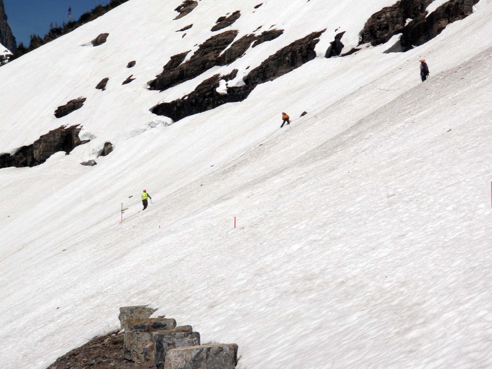
A survey crew standing on top of a snow drift many times their height, beside a road cut through the snow
The Big Drift on Going-to-the-Sun Road, surveyed before plowing begins. It forms in the same place every year because the wind does the same thing every year, and it is routinely eighty feet deep. This is what stands between a spring thaw and an open gate, and it is why a median opening date has a two month spread around it on almost every road here. “Going-to-the-Sun Road - Surveying the Big Drift (5888850828)” by GlacierNPS, CC BY 2.0
Common questions

Colorado mountain pass FAQ

Mountain passes by state

Advertisement

Mountain passes across the country, including the states with no page and the specific reason for each, and park road openings, which is the spring half of the same question.

Historic dates on this page come from the publishers named beside each table and were read on 4 September 2026. National Park Service material is a United States government work in the public domain and is reproduced. State highway department material is not, so their dates are restated here in our own structure. Measured snow depth comes from USDA NRCS SNOTEL, and live weather products from api.weather.gov, both federal and both public domain.
Gate status is published by the agencies linked above. The dates here are records of past seasons, and a median is a record of what happened rather than a statement about the road today.
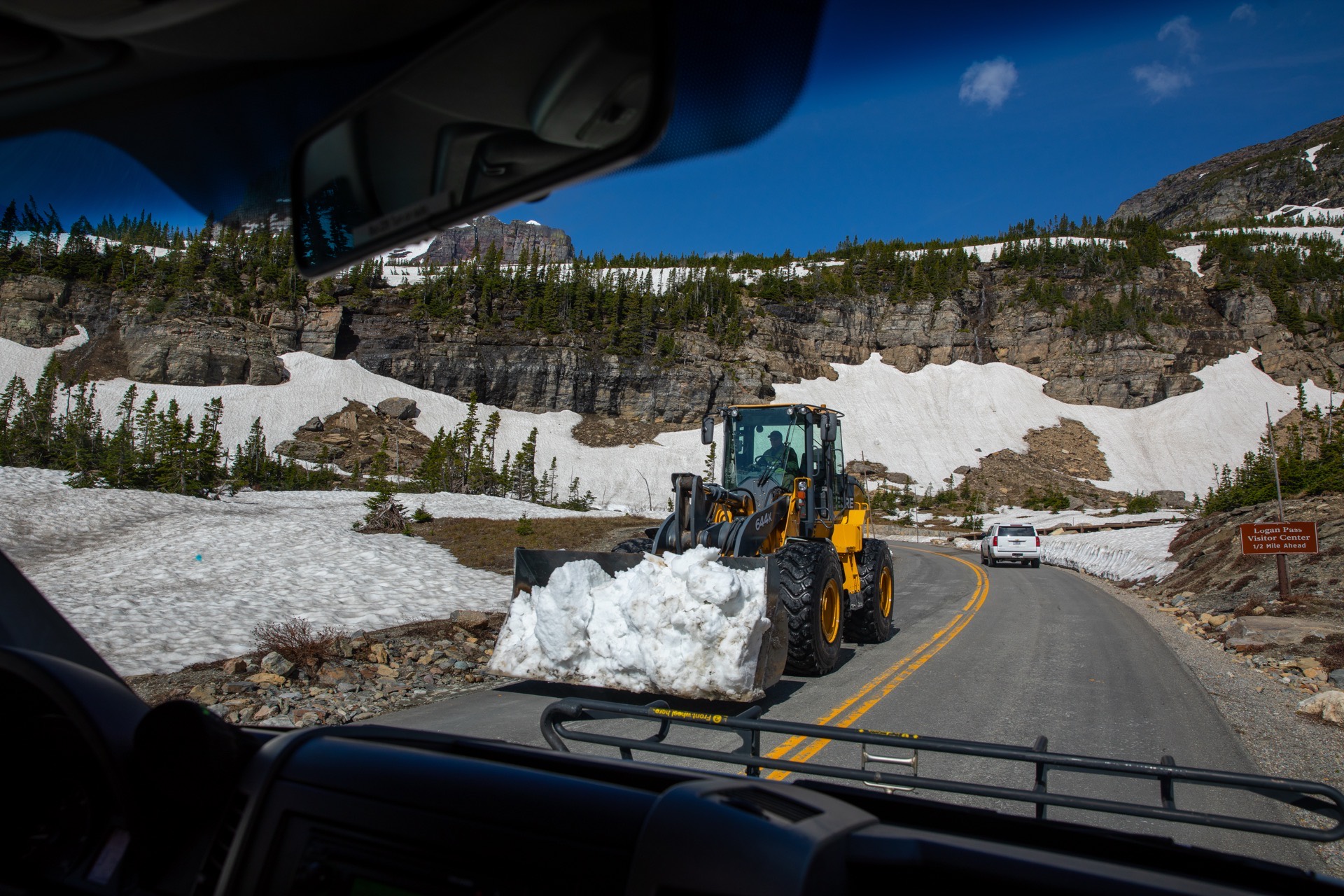
Hero image: “Snowplows at Logan Pass (52201734565)” — GlacierNPS — Public domain