Every California pass worth naming, how high it is, whether it gates for the winter or stays open, what the record says about when the gate moves, and the agency that publishes today's status.
In the seasons the agencies have published, Tioga Road has closed around November 13. That is a median of past seasons; today's status is with the agency linked below.
Passes on this page
18
Gated for winter
12
With a published record
11
With a snow station on them
5
Current status
Where California pass status is published
Check the agency below before you drive. Gate decisions are made by highway crews and park rangers looking at the road, and they change inside a day.
California has the richest live feed of any state, a chain control record for over a thousand points on its highways refreshed about once a minute, and the least historic depth to go with it: its own published table of Sierra gate dates covers seven winters. So the two halves of this page come from different places. The gates that close, Tioga and Sonora and Ebbetts and Monitor, have a short state record and, where the road runs through a national park, a much longer federal one. The passes that stay open, Donner and Echo and the Grapevine, have no dates at all and a chain control status instead.
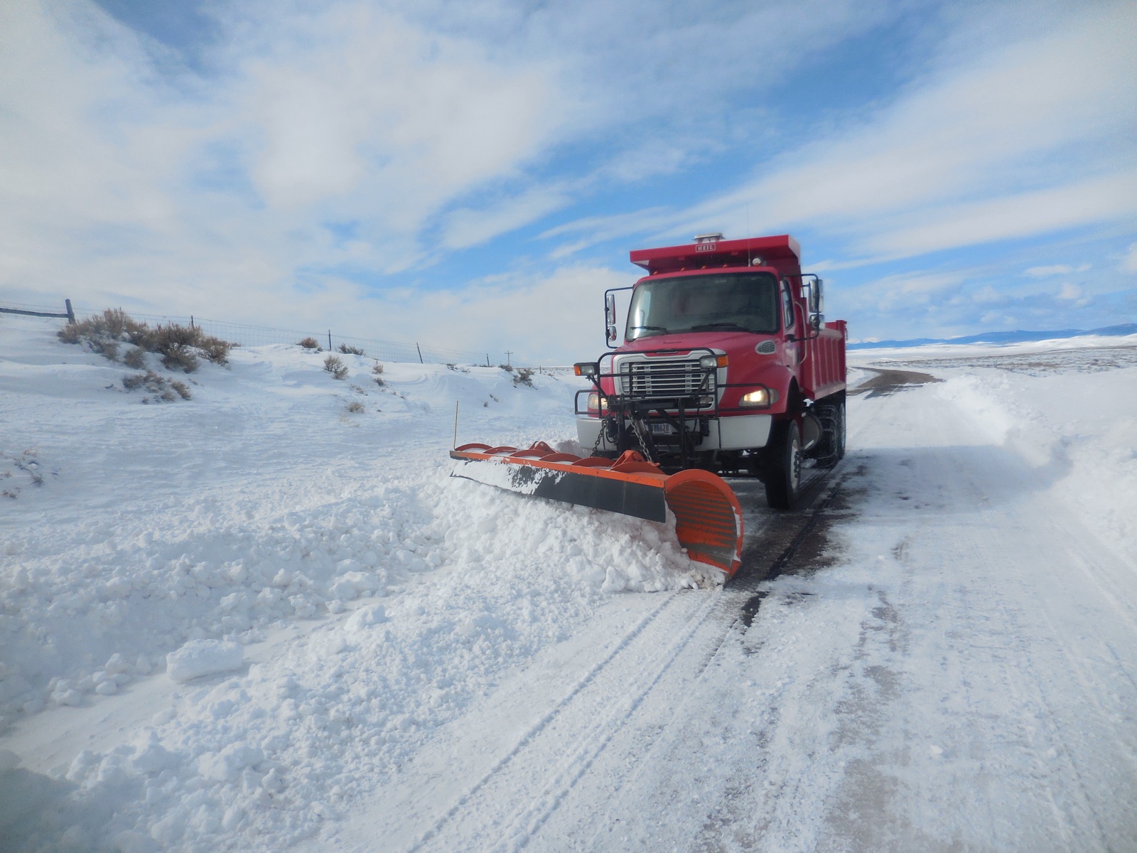
The reason a gate date is not a calendar date. Reopening a gated pass is not a matter of waiting for a thaw: a crew drives a rotary blower into drifts that can stand thirty feet above the pavement, and they do it under slopes that are still loaded. That is why the same road can open on 2 April in one year and 22 July in another, and why no agency on this page will name a date in advance. “Snow Plowing Jones Hole Highway (51313598806)” — USFWS Mountain Prairie — Public domain
Measured right now
What instruments are reading on the California passes
Check the agency below before you drive. Gate decisions are made by highway crews and park rangers looking at the road, and they change inside a day.
California is the one state here with a live road reading a browser can fetch without a key. Caltrans publishes a chain control code for more than a thousand named points on its highways and rewrites the file about once a minute. What follows is one district at a time, because the agency sends these files uncompressed and a single district runs from ten kilobytes to two hundred.
Reading Caltrans chain control for District 09.
Measured snow on the passes
Reading measured snow depth from SNOTEL.
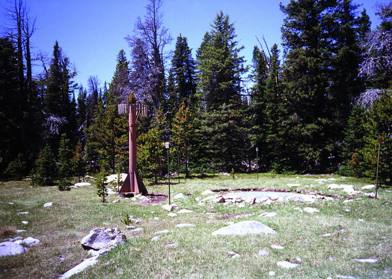
A SNOTEL station: a sonic ranger on the mast measuring the distance down to the snow surface, and a fluid filled pillow buried under the pack weighing the water in it. That second number is the one that matters to a plow crew, because two feet of dry January powder and two feet of April corn are not the same job. Note also what the picture shows: a clearing in trees, not a roadway. This is why every depth on this page carries its station name and elevation. “Cloud Peak SNOTEL site in Montana” — USDA Natural Resources Conservation Service — Public Domain
National Weather Service winter products for California
Twenty of the National Weather Service’s one hundred and eleven product types are winter or road relevant, from a Winter Weather Advisory to a Snow Squall Warning to an Avalanche Warning. They are federal works in the public domain, which is why this is the one place on the page where somebody else’s live sentences appear word for word rather than in our own.
Reading National Weather Service products for California.
The forecast at one pass
A forecast for a valley town is not a forecast for the pass above it. Pick a pass and this reads the National Weather Service grid at that pass’s own coordinates, one pass at a time.
Advertisement
The map
Every California pass on one map
Colour is winter behaviour: a purple or teal marker is a road with a gate that shuts for the season, and a dark marker is a road kept open all winter where what changes is the traction requirement. Enter a ZIP and the map moves to your state and names the county it matched, a county level match from the Census relationship file.
Style
Area
Size
Seasonal gatePark road gateOpen all winterCounty road gate
18 passes around California. Colour is how the road behaves in winter: gated for the season, or kept open under chain control. Current status is published by the agency linked from each state page.
The record
What the published record says about the California gates
Check the agency below before you drive. Gate decisions are made by highway crews and park rangers looking at the road, and they change inside a day.
Tioga Road
inside Yosemite, 9,945 feet. The park half of the Tioga Pass crossing, from Crane Flat to the entrance station at 9,945 feet. The National Park Service closes this gate and Caltrans closes a different one further east, which is why this page keeps two Tioga records.
Closing dates across 46 recorded seasons from 1980 to 2025
SepOctNovDecJanFeb
Median November 13. Earliest October 17 in 2004. Latest January 17 in 2011. That is a spread of 92 days, which is the number that matters more than the median does.
Reopening dates across 68 recorded seasons from 1957 to 2025
MarAprMayJunJulAug
Median May 24. Earliest April 8 in 1977. Latest July 22 in 2023. That is a spread of 105 days, which is the number that matters more than the median does.
Tioga Road inside Yosemite, the park half of the Tioga Pass crossing. The gate is Crane Flat to the Tioga Pass entrance station, closed by the National Park Service.
Season
Opened
Closed
Snow that winter
2025
May 26
Nov 12
72% of normal on 1 April
2024
Jun 10
Nov 11
99% of normal on 1 April
2023
Jul 22
Nov 15
244% of normal on 1 April
2022
May 27
Oct 31
41% of normal on 1 April
2021
May 27
Oct 21
63% of normal on 1 April
2020
Jun 15
Nov 5
46% of normal on 1 April
2019
Jul 1
Nov 19
176% of normal on 1 April
2018
May 21
Nov 20
67% of normal on 1 April
2017
Jun 29
Nov 14
177% of normal on 1 April
2016
May 18
Nov 16
89% of normal on 1 April
2015
May 4
Nov 1
7% of normal on 1 April
2014
May 2
Nov 13
33% of normal on 1 April
2013
May 11
Nov 18
52% of normal on 1 April
2012
May 7
Nov 8
43% of normal on 1 April
2011
Jun 18
Jan 17 2012
178% of normal on 1 April
The National Park Service dataset reads Dec 31 for the 2011 Tioga closing. The correct value is 17 January 2012, the latest Tioga closing on record, which is the value the shifted column had written on the 2010 row.
2010
Jun 5
Nov 19
107% of normal on 1 April
The National Park Service dataset reads Jan 17 for the 2010 Tioga closing. The closing column is shifted one row upward here: the correct 2010 value is November 19, and Jan 17 belongs to the following season.
2009
May 19
Nov 12
92% of normal on 1 April
2008
May 21
Oct 30
99% of normal on 1 April
2007
May 11
Dec 6
46% of normal on 1 April
2006
Jun 17
Nov 27
129% of normal on 1 April
2005
Jun 24
Nov 25
163% of normal on 1 April
2004
May 14
Oct 17
83% of normal on 1 April
2003
May 31
Oct 31
65% of normal on 1 April
2002
May 22
Nov 5
95% of normal on 1 April
2001
May 12
Nov 11
67% of normal on 1 April
2000
May 18
Nov 9
97% of normal on 1 April
1999
May 28
Nov 23
110% of normal on 1 April
1998
Jul 1
Nov 12
156% of normal on 1 April
1997
Jun 13
Nov 12
105% of normal on 1 April
1996
May 31
Nov 5
111% of normal on 1 April
The National Park Service dataset reads May 13 for the 1996 Tioga opening. Archived captures of the same dataset and the Mono Lake Committee series both give May 31, and 13 looks like a transposition of 31.
1995
Jun 30
Dec 11
178% of normal on 1 April
1994
May 25
Nov 10
51% of normal on 1 April
1993
Jun 3
Nov 24
159% of normal on 1 April
1992
May 15
Nov 10
58% of normal on 1 April
1991
May 26
Nov 14
79% of normal on 1 April
1990
May 17
Nov 19
45% of normal on 1 April
1989
May 12
Nov 24
83% of normal on 1 April
1988
Apr 29
Nov 14
31% of normal on 1 April
1987
May 2
Nov 13
51% of normal on 1 April
1986
May 24
Nov 29
137% of normal on 1 April
Showing the most recent 40 of 68 recorded seasons. The full record is published by the agency at the link below.
Three cells in the federal Yosemite dataset are corrected here
The National Park Service dataset behind the Tioga Road record is live, and three of its cells cannot be right. Two independent sources agree against it on all three: archived captures of the same dataset, and the Mono Lake Committee’s own compilation, which is a private copyrighted work used here only as evidence that a cell is wrong and named for that reason. Every corrected cell is marked in the table above.
1996. The National Park Service dataset reads May 13 for the 1996 Tioga opening. Archived captures of the same dataset and the Mono Lake Committee series both give May 31, and 13 looks like a transposition of 31.
2010. The National Park Service dataset reads Jan 17 for the 2010 Tioga closing. The closing column is shifted one row upward here: the correct 2010 value is November 19, and Jan 17 belongs to the following season.
2011. The National Park Service dataset reads Dec 31 for the 2011 Tioga closing. The correct value is 17 January 2012, the latest Tioga closing on record, which is the value the shifted column had written on the 2010 row.
There are two Tioga closing dates and they are not the same number
The National Park Service closes Tioga Road inside Yosemite. Caltrans closes State Route 120 between US 395 and the park boundary, further east and lower down. Both publish a Tioga closing date. Across the 7 seasons both agencies have published, the Caltrans gate has gone up later every single time, by between 6 and 56 days, with a median gap of 17 days. The opening dates, by contrast, agree exactly in all 6 overlapping seasons, which is what makes the closing difference so easy to miss. This page keeps them as two records with each gate named.
If you are driving from the east, the Caltrans gate is the one you meet first. If you are driving from the Valley, the park gate is. The hub lists both.
Tioga Pass, State Route 120 east of the park
SR 120, 9,937 feet. The Caltrans gate on SR 120 between US 395 and the park boundary. Caltrans has closed it six to seventeen days later than the park closes its own gate in every season both agencies have published.
Closing dates across 7 recorded seasons
SepOctNovDecJanFeb
Median November 25. Earliest November 17 in the 2022/2023 winter. Latest December 19 in the 2025/2026 winter. That is a spread of 32 days, which is the number that matters more than the median does.
Reopening dates across 7 recorded seasons
MarAprMayJunJulAug
Median May 27. Earliest April 15 in the 2025/2026 winter. Latest July 22 in the 2022/2023 winter. That is a spread of 98 days, which is the number that matters more than the median does.
Tioga Pass on SR 120, by winter rather than by year, which is how Caltrans publishes it.
Winter
Gate closed
Gate reopened
2025/2026
Dec 19 2025
Apr 15 2026
2024/2025
Nov 25 2024
May 26 2025
2023/2024
Nov 21 2023
Jun 10 2024
2022/2023
Nov 17 2022
Jul 22 2023
2021/2022
Dec 16 2021
May 27 2022
2020/2021
Nov 25 2020
May 27 2021
2019/2020
Nov 27 2019
Jun 15 2020
State record: California Department of Transportation. Not public domain, so the dates are restated in our own structure rather than copied. Read on 4 September 2026.
Glacier Point Road
inside Yosemite, 7,214 feet. Sixteen miles from Badger Pass to the Glacier Point overlook. It did not open at all in 2022 for a rebuild, which is in the record as "did not open" rather than as a gap, and that distinction matters when you take a median.
Closing dates across 27 recorded seasons from 1995 to 2025
SepOctNovDecJanFeb
Median November 14. Earliest October 31 in 2003. Latest December 12 in 2008. That is a spread of 42 days, which is the number that matters more than the median does.
Reopening dates across 30 recorded seasons from 1995 to 2025
MarAprMayJunJulAug
Median May 15. Earliest March 28 in 2015. Latest July 15 in 2023. That is a spread of 109 days, which is the number that matters more than the median does.
Glacier Point Road. The gate is Badger Pass to Glacier Point.
SR 89, 8,512 feet. Thirty miles across the park with the deepest roadside snowpack in California. The park publishes the 1 April snow depth at Lake Helen beside every opening date, which makes it the one record where the cause and the effect sit in the same row.
Closing dates across 46 recorded seasons from 1980 to 2025
SepOctNovDecJanFeb
Median November 11. Earliest October 18 in 1996. Latest December 18 in 2013. That is a spread of 61 days, which is the number that matters more than the median does.
Reopening dates across 47 recorded seasons from 1980 to 2026
MarAprMayJunJulAug
Median June 2. Earliest April 28 in 1990. Latest July 26 in 2017. That is a spread of 89 days, which is the number that matters more than the median does.
Lassen park highway, State Route 89 through the park. The gate is the 30 mile section between the Kohm Yah-mah-nee and Manzanita Lake ends.
Season
Opened
Closed
Snow that winter
2026
May 22
not published
91" on 1 April plowing began Apr 2
2025
Jun 27
Oct 24
208" on 1 April plowing began Apr 21
2024
Jun 20
Dec 6
193" on 1 April plowing began Apr 30
2023
Jul 1
Dec 5
217" on 1 April plowing began May 15
2022
Jun 3
Nov 6
96" on 1 April plowing began Mar 16
2021
May 17
Oct 21
114.5" on 1 April plowing began Apr 5
2020
May 29
Nov 13
119" on 1 April plowing began Mar 19
2019
Jun 22
Nov 29
238" on 1 April plowing began Apr 18
2018
May 27
Nov 20
131" on 1 April plowing began Mar 30
2017
Jul 26
Nov 10
243" on 1 April plowing began Apr 4
2016
Jun 12
Oct 30
199" on 1 April plowing began Apr 18
2015
May 3
Nov 8
91" on 1 April plowing began Mar 31
2014
May 19
Dec 1
122" on 1 April plowing began Apr 3
2013
May 24
Dec 18
140" on 1 April plowing began Mar 21
2012
Jun 1
Nov 19
145" on 1 April plowing began Apr 21
2011
Jul 16
Nov 22
242" on 1 April plowing began Apr 19
2010
Jul 8
Oct 23
169" on 1 April plowing began Apr 19
2009
Jun 4
Nov 18
146" on 1 April plowing began Apr 13
2008
May 18
Dec 12
132" on 1 April plowing began Mar 31
2007
May 18
Dec 6
112" on 1 April plowing began Apr 2
2006
Jul 6
Nov 11
266" on 1 April plowing began Apr 3
2005
Jun 2
Nov 8
173" on 1 April plowing began Apr 4
2004
May 27
Oct 28
187" on 1 April plowing began Mar 11
2003
May 23
Nov 7
185" on 1 April plowing began Mar 26
2002
May 22
Nov 13
166" on 1 April plowing began Apr 1
2001
May 10
Nov 15
109" on 1 April plowing began Apr 2
2000
Jun 2
Nov 17
178" on 1 April plowing began Apr 3
1999
Jun 11
Nov 19
194" on 1 April plowing began Apr 12
1998
Jul 12
Nov 10
250" on 1 April plowing began Apr 5
1997
Jun 5
Nov 14
135" on 1 April plowing began Apr 7
1996
Jun 12
Oct 18
171" on 1 April plowing began Apr 1
1995
Jul 21
Nov 21
287" on 1 April plowing began Mar 19
1994
May 20
Nov 7
101" on 1 April plowing began Apr 3
1993
Jun 28
Nov 10
225" on 1 April plowing began Apr 12
1992
May 14
Oct 29
127" on 1 April plowing began Apr 6
1991
May 24
Oct 22
151" on 1 April plowing began Apr 7
1990
Apr 28
Nov 14
106" on 1 April plowing began Apr 1
1989
Jun 6
Oct 23
223" on 1 April plowing began Apr 3
1988
May 20
Nov 7
98" on 1 April plowing began Apr 2
1987
May 15
Nov 13
138" on 1 April plowing began Apr 20
Showing the most recent 40 of 47 recorded seasons. The full record is published by the agency at the link below.
SR 108, 9,624 feet. The steepest paved pass in the Sierra, with a 26 percent grade on the east side, gated at a winter closure point six miles west of US 395. Its SNOTEL station sits at 8,770 feet just below the summit.
Closing dates across 7 recorded seasons
SepOctNovDecJanFeb
Median December 16. Earliest November 18 in the 2022/2023 winter. Latest January 2 in the 2023/2024 winter. That is a spread of 45 days, which is the number that matters more than the median does.
Reopening dates across 7 recorded seasons
MarAprMayJunJulAug
Median May 15. Earliest April 30 in the 2025/2026 winter. Latest June 9 in the 2022/2023 winter. That is a spread of 40 days, which is the number that matters more than the median does.
Sonora Pass on SR 108, by winter rather than by year, which is how Caltrans publishes it.
Winter
Gate closed
Gate reopened
2025/2026
Dec 25 2025
Apr 30 2026
2024/2025
Dec 16 2024
May 15 2025
2023/2024
Jan 2 2024
May 16 2024
2022/2023
Nov 18 2022
Jun 9 2023
2021/2022
Dec 16 2021
May 12 2022
2020/2021
Dec 15 2020
May 6 2021
2019/2020
Dec 2 2019
May 15 2020
State record: California Department of Transportation. Not public domain, so the dates are restated in our own structure rather than copied. Read on 4 September 2026.
Ebbetts Pass
SR 4, 8,730 feet. A one lane road with no centre line over the crest, and one of the five Caltrans chain control points strung along SR 4 between 5,744 and 7,591 feet, which is how the agency reports a long climb rather than a point.
Closing dates across 7 recorded seasons
SepOctNovDecJanFeb
Median December 16. Earliest November 18 in the 2022/2023 winter. Latest January 2 in the 2023/2024 winter. That is a spread of 45 days, which is the number that matters more than the median does.
Reopening dates across 6 recorded seasons
MarAprMayJunJulAug
Median May 12. Earliest May 8 in the 2024/2025 winter. Latest June 8 in the 2022/2023 winter. That is a spread of 31 days, which is the number that matters more than the median does.
Ebbetts Pass on SR 4, by winter rather than by year, which is how Caltrans publishes it.
Winter
Gate closed
Gate reopened
2025/2026
Dec 26 2025
not published
2024/2025
Dec 16 2024
May 8 2025
2023/2024
Jan 2 2024
May 9 2024
2022/2023
Nov 18 2022
Jun 8 2023
2021/2022
Dec 16 2021
May 12 2022
2020/2021
Dec 15 2020
May 12 2021
2019/2020
Dec 2 2019
May 15 2020
Caltrans has recorded a closing but not a reopening for the 2025/2026 winter. That is a gap in the agency’s own table rather than a road that never reopened, and it is left as a gap here.
State record: California Department of Transportation. Not public domain, so the dates are restated in our own structure rather than copied. Read on 4 September 2026.
Monitor Pass
SR 89, 8,314 feet. The outlier of the Sierra gates. Monitor faces east into dry air and has closed as late as 18 February and reopened as early as 5 March, so its season is both the shortest and the least predictable of the four.
Closing dates across 7 recorded seasons
SepOctNovDecJanFeb
Median December 16. Earliest December 2 in the 2019/2020 winter. Latest February 18 in the 2024/2025 winter. That is a spread of 78 days, which is the number that matters more than the median does.
Reopening dates across 7 recorded seasons
MarAprMayJunJulAug
Median April 9. Earliest March 5 in the 2025/2026 winter. Latest May 12 in the 2022/2023 winter. That is a spread of 68 days, which is the number that matters more than the median does.
Monitor Pass on SR 89, by winter rather than by year, which is how Caltrans publishes it.
Winter
Gate closed
Gate reopened
2025/2026
Dec 26 2025
Mar 5 2026
2024/2025
Feb 18 2025
Apr 7 2025
2023/2024
Jan 2 2024
Apr 10 2024
2022/2023
Dec 8 2022
May 12 2023
2021/2022
Dec 16 2021
Apr 1 2022
2020/2021
Dec 16 2020
Apr 9 2021
2019/2020
Dec 2 2019
May 8 2020
State record: California Department of Transportation. Not public domain, so the dates are restated in our own structure rather than copied. Read on 4 September 2026.
Lassen Loop, the Caltrans half of SR 89
SR 89, 8,512 feet. Caltrans publishes its own gate dates for the SR 89 loop past Lassen alongside the park’s. The two describe overlapping but not identical stretches of the same road, which is the same trap as Tioga.
Closing dates across 7 recorded seasons
SepOctNovDecJanFeb
Median November 15. Earliest October 28 in the 2021/2022 winter. Latest December 9 in the 2024/2025 winter. That is a spread of 42 days, which is the number that matters more than the median does.
Reopening dates across 7 recorded seasons
MarAprMayJunJulAug
Median June 3. Earliest April 7 in the 2025/2026 winter. Latest July 3 in the 2022/2023 winter. That is a spread of 87 days, which is the number that matters more than the median does.
Lassen Loop on SR 89, by winter rather than by year, which is how Caltrans publishes it.
Winter
Gate closed
Gate reopened
2025/2026
Nov 7 2025
Apr 7 2026
2024/2025
Dec 9 2024
Jun 30 2025
2023/2024
Nov 27 2023
Jun 24 2024
2022/2023
Nov 15 2022
Jul 3 2023
2021/2022
Oct 28 2021
Jun 3 2022
2020/2021
Nov 10 2020
May 17 2021
2019/2020
Nov 29 2019
May 22 2020
State record: California Department of Transportation. Not public domain, so the dates are restated in our own structure rather than copied. Read on 4 September 2026.
June Lake Loop
SR 158, 7,234 feet. Gated at both ends, four miles north of June Lake village and at the north junction with US 395, so the loop becomes two dead end spurs for the winter rather than closing entirely.
Closing dates across 7 recorded seasons
SepOctNovDecJanFeb
Median December 16. Earliest November 26 in the 2019/2020 winter. Latest February 13 in the 2024/2025 winter. That is a spread of 79 days, which is the number that matters more than the median does.
Reopening dates across 7 recorded seasons
MarAprMayJunJulAug
Median March 26. Earliest February 26 in the 2019/2020 winter. Latest April 27 in the 2022/2023 winter. That is a spread of 61 days, which is the number that matters more than the median does.
June Lake Loop on SR 158, by winter rather than by year, which is how Caltrans publishes it.
Winter
Gate closed
Gate reopened
2025/2026
Dec 27 2025
Mar 23 2026
2024/2025
Feb 13 2025
Apr 7 2025
2023/2024
Feb 1 2024
Apr 9 2024
2022/2023
Dec 12 2022
Apr 27 2023
2021/2022
Dec 16 2021
Mar 21 2022
2020/2021
Dec 15 2020
Mar 26 2021
2019/2020
Nov 26 2019
Feb 26 2020
State record: California Department of Transportation. Not public domain, so the dates are restated in our own structure rather than copied. Read on 4 September 2026.
Mammoth Lakes Basin and Reds Meadow
SR 203, 8,973 feet. The Reds Meadow gate at 8,973 feet is the highest winter closure gate in the Caltrans chain control feed outside Yosemite, and it shuts earlier than any other California gate on this page.
Closing dates across 7 recorded seasons
SepOctNovDecJanFeb
Median November 4. Earliest October 15 in the 2025/2026 winter. Latest November 9 in the 2023/2024 winter. That is a spread of 25 days, which is the number that matters more than the median does.
Reopening dates across 6 recorded seasons
MarAprMayJunJulAug
Median June 5. Earliest May 28 in the 2019/2020 winter. Latest July 14 in the 2022/2023 winter. That is a spread of 47 days, which is the number that matters more than the median does.
Mammoth Lakes on SR 203, by winter rather than by year, which is how Caltrans publishes it.
Winter
Gate closed
Gate reopened
2025/2026
Oct 15 2025
not published
2024/2025
Nov 1 2024
Jun 3 2025
2023/2024
Nov 9 2023
Jun 7 2024
2022/2023
Nov 4 2022
Jul 14 2023
2021/2022
Oct 22 2021
Jun 17 2022
2020/2021
Nov 6 2020
Jun 2 2021
2019/2020
Nov 4 2019
May 28 2020
Caltrans has recorded a closing but not a reopening for the 2025/2026 winter. That is a gap in the agency’s own table rather than a road that never reopened, and it is left as a gap here.
State record: California Department of Transportation. Not public domain, so the dates are restated in our own structure rather than copied. Read on 4 September 2026.
Lake Sabrina to Aspendell
SR 168, 9,128 feet. The last two miles of the Bishop Creek road above Aspendell, gated every winter. A short closure, but it is the one that decides whether the eastern Sierra trailheads at Sabrina and North Lake are reachable.
Closing dates across 7 recorded seasons
SepOctNovDecJanFeb
Median November 16. Earliest November 3 in the 2025/2026 winter. Latest December 16 in the 2021/2022 winter. That is a spread of 43 days, which is the number that matters more than the median does.
Reopening dates across 7 recorded seasons
MarAprMayJunJulAug
Median April 25. Earliest April 15 in the 2020/2021 winter. Latest June 1 in the 2022/2023 winter. That is a spread of 47 days, which is the number that matters more than the median does.
Lake Sabrina to Aspendell on SR 168, by winter rather than by year, which is how Caltrans publishes it.
Winter
Gate closed
Gate reopened
2025/2026
Nov 3 2025
Apr 16 2026
2024/2025
Nov 13 2024
Apr 25 2025
2023/2024
Nov 15 2023
Apr 18 2024
2022/2023
Nov 16 2022
Jun 1 2023
2021/2022
Dec 16 2021
Apr 26 2022
2020/2021
Nov 18 2020
Apr 15 2021
2019/2020
Nov 26 2019
May 1 2020
State record: California Department of Transportation. Not public domain, so the dates are restated in our own structure rather than copied. Read on 4 September 2026.
Why the Sierra gates close so much later than you expect
The California gates are the surprise of the whole set. Washington and Colorado gates go up in the second half of November. The four Sierra gates hold open, in the median, well into December, and Monitor Pass has stayed open until the middle of February and reopened as early as the first week of March. The reason is that a Sierra gate closes when a storm arrives rather than when a season does: the east side is dry, the road is plowed until it is not worth plowing, and a warm autumn simply postpones the decision.
“The park does not have an established date for the full opening of the park road.”
A work of the United States government, in the public domain, so it is reproduced word for word. Read on 4 September 2026.
Gates without a published year by year record
Each of these closes for the winter. The agency publishes the road and a general window rather than a year by year record, so there is no median to compute; single seasons appear in press releases, and the agency pointer above carries the current status.
Angeles Crest Highway, SR 2, 7,903 feet. Five gates between La Canada and Islip Saddle, and the one place where the Caltrans lane closure feed carries a genuine winter closure record rather than a chain control code. Its indefinite closure has been on the books since December 2025.
If Caltrans starts publishing a table for any of these, it will appear here.
Every pass
The full California inventory, gated and year round together
The two kinds of pass are searched for in identical words and answered in opposite ways, so they are on one table rather than two pages. A gated road has a date. A road kept open all winter does not, and anyone who tells you it usually closes in November has confused it with a different road. The list here is the California passes that appear in a machine readable agency feed, carry a snowpack station named after them, or have a published date record, which is the inventory that can be checked against a source.
Pass
Route
Elevation
Winter behaviour
Snow station on it
Tioga Road
inside Yosemite
9,945 ft
Park road gate closes for winter, run by a park
none
Tioga Pass, State Route 120 east of the park
SR 120
9,937 ft
Seasonal gate closes for winter
none
Sonora Pass
SR 108
9,624 ft
Seasonal gate closes for winter
Sonora Pass, 8,770 ft
Lake Sabrina to Aspendell
SR 168
9,128 ft
Seasonal gate closes for winter
none
Mammoth Lakes Basin and Reds Meadow
SR 203
8,973 ft
Seasonal gate closes for winter
none
Ebbetts Pass
SR 4
8,730 ft
Seasonal gate closes for winter
Ebbetts Pass, 8,660 ft
Carson Pass
SR 88
8,574 ft
Open all winter stays open, chains or traction may be required
Carson Pass, 8,360 ft
Lassen park highway
SR 89
8,512 ft
Park road gate closes for winter, run by a park
none
Lassen Loop, the Caltrans half of SR 89
SR 89
8,512 ft
Seasonal gate closes for winter
none
Onyx Summit
SR 38
8,443 ft
Open all winter stays open, chains or traction may be required
none
Monitor Pass
SR 89
8,314 ft
Seasonal gate closes for winter
Monitor Pass, 8,320 ft
Angeles Crest Highway
SR 2
7,903 ft
Seasonal gate closes for winter
none
Echo Summit
US 50
7,401 ft
Open all winter stays open, chains or traction may be required
none
Donner Summit
I-80
7,239 ft
Open all winter stays open, chains or traction may be required
none
June Lake Loop
SR 158
7,234 ft
Seasonal gate closes for winter
none
Glacier Point Road
inside Yosemite
7,214 ft
Park road gate closes for winter, run by a park
none
Cedar Pass
SR 299
6,305 ft
Open all winter stays open, chains or traction may be required
Cedar Pass, 7,060 ft
Tejon Pass, the Grapevine
I-5
4,144 ft
Open all winter stays open, chains or traction may be required
none
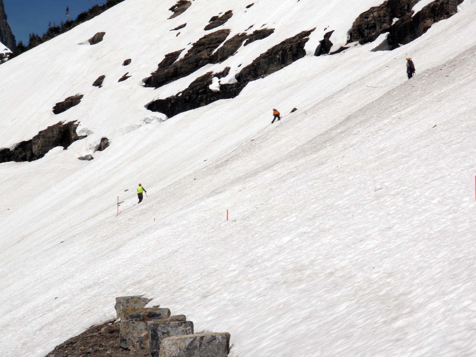
The Big Drift on Going-to-the-Sun Road, surveyed before plowing begins. It forms in the same place every year because the wind does the same thing every year, and it is routinely eighty feet deep. This is what stands between a spring thaw and an open gate, and it is why a median opening date has a two month spread around it on almost every road here. “Going-to-the-Sun Road - Surveying the Big Drift (5888850828)” by GlacierNPS, CC BY 2.0
Common questions
California mountain pass FAQ
California Department of Transportation publishes it, at Caltrans QuickMap, and that is the page to plan on. California gates are opened and closed by people looking at the road, sometimes several times in a week. What this page holds is the record of how California gates have behaved in past seasons, the measured snowpack at the stations nearest them, and the link and phone number for the agency.
It depends heavily on which road, which is why this page gives a figure per road rather than one for the state. Tioga Road has the deepest record here: across 46 recorded seasons its median closing is November 13, with the earliest on record October 17 in 2004 and the latest January 17 in 2011. That is a spread of 92 days around a median, which is the number that matters: the median tells you when to start paying attention and the spread tells you how little it guarantees.
Carson Pass on SR 88, Echo Summit on US 50, Donner Summit on I-80, Tejon Pass, the Grapevine on I-5, Onyx Summit on SR 38, Cedar Pass on SR 299. These are maintained through the winter and have no seasonal date at all. What varies on them is traction requirements, avalanche control holds and storm closures that last hours rather than months. They are on this page because they are searched for in exactly the same words as the gated ones, and telling the two apart is most of the value of a page like this.
Tioga Road on inside Yosemite, at 9,945 feet. The park half of the Tioga Pass crossing, from Crane Flat to the entrance station at 9,945 feet. The National Park Service closes this gate and Caltrans closes a different one further east, which is why this page keeps two Tioga records.
This page reads it live from the USDA Natural Resources Conservation Service SNOTEL network, which has 5 stations named for and sited at a California pass on this page. Those are physical measurements, a sonic ranger over the snow and a fluid pillow under it, taken at a named station with a stated elevation and a stated date. They are not roadway measurements: a SNOTEL site is an unplowed forest clearing that can sit hundreds of feet above or below the pavement, so read the depth as what the mountain is holding rather than as what the road looks like.
Because no agency publishes one. Angeles Crest Highway is gated for the winter and has no year by year record from any agency: isolated single seasons appear in press releases, and that is all, so there is no median to compute. If Caltrans or a park starts publishing a table, it will appear here.
They are the codes Caltrans itself publishes for each named point on its highways, passed through untouched with the point name, the elevation and the timestamp the agency stamped on them. R-0 means no chain controls are in effect at that point. Every code is checked against the published set before it is shown, because the feed carries the occasional malformed record. The higher restriction levels are shown as codes rather than paraphrased, because the agency’s own wording is what governs whether you may proceed.
Because they are closing two different gates. The National Park Service closes Tioga Road inside Yosemite. Caltrans closes State Route 120 between US 395 and the park boundary, further east and lower down. Across the 7 seasons both agencies have published, the Caltrans gate has gone up later every single time, by between 6 and 56 days, with a median gap of 17 days. The opening dates, by contrast, agree exactly in all 6 overlapping seasons, which is precisely what makes the closing difference easy to miss. This page keeps them as two records with each gate named and never combines them.
California Department of Transportation at Caltrans QuickMap; and National Park Service, Yosemite National Park at the Yosemite current conditions page; and National Park Service, Lassen Volcanic National Park at the Lassen Volcanic conditions page. Caltrans also runs a recorded line on 1-800-427-7623, the Caltrans Highway Information Network, a recorded line that reads out conditions by route number. Every one of those links was checked on 4 September 2026 and returned a working page. They are the source of record for anything happening today.
18: 12 that close behind a gate for the winter and 6 that stay open and are chain or traction controlled instead. 11 of them carry a published year by year record, which is what the tables on this page are built from. The list is the California passes that appear in a machine readable agency feed, have a snowpack station named after them, or carry a published date record, which is the inventory that can be checked against a source.
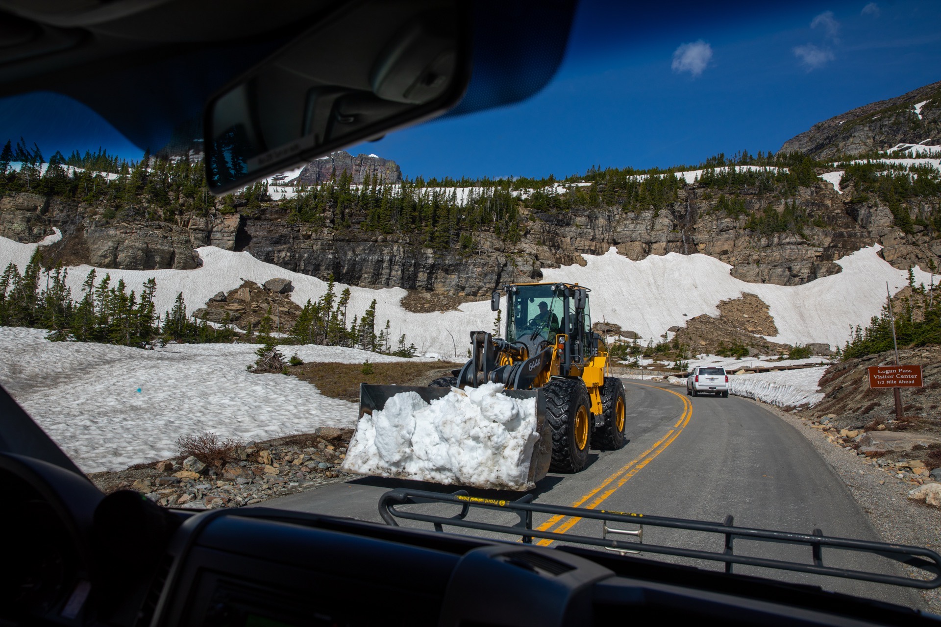
Historic dates on this page come from the publishers named beside each table and were read on 4 September 2026. National Park Service material is a United States government work in the public domain and is reproduced. State highway department material is not, so their dates are restated here in our own structure. Measured snow depth comes from USDA NRCS SNOTEL, and live weather products from api.weather.gov, both federal and both public domain. Gate status is published by the agencies linked above. The dates here are records of past seasons, and a median is a record of what happened rather than a statement about the road today. Hero image: “Snowplows at Logan Pass (52201734565)” — GlacierNPS — Public domain