
Skip to content
Spring fish runs in Minnesota

Minnesota Spring Fish Runs: Walleye and Rainbow Smelt

Walleye run up the Rainy River from Lake of the Woods and up the St. Louis River to the Fond du Lac Dam; Lake Superior smelt wait for water near 40°F.

Minnesota at a glance

Read October 13, 2026
3
Runs
on 3 waters
2
Species
walleye and rainbow smelt
April
First to start
Walleye on the St. Louis River
40 to 50°F
Spawning water
rainbow smelt to walleye
1
USGS gauge
on the St. Louis River

Months, temperatures and places are the agency’s own, quoted on each run below. The verdict on each card is worked out in your browser against today and the latest reading at the gauge on that river.

Is the run on?

Every Minnesota run, and where it stands today

Walleye

Walleye on the Rainy River

When
Usually April and May, going by Minnesota's other walleye run, on the St. Louis River.
The run
Lake of the Woods upstream to the International Falls dam
Where to go
Wheeler’s Point Access, Baudette Access in Timbermill Park, Vidas Access, Frontier Access, Nelson Park, Upper Sault Access, Manitou Rapids Access, Kuttes Landing, Ron Hall Memorial Access
Rainy River offers excellent walleye fishing. Each spring, walleye migrate from Lake of the Woods to the Rainy River to spawn. Many of those fish are still in the river when the walleye season opens in May.
Minnesota Department of Natural Resources, read October 13, 2026. Read it at the source
The rules on this water (2), where to fish and notes
LimitMarch 1 to April 14 each year (2026 regulations)
EXCEPTION: Rainy River (Mouth to the dam at International Falls and all tributaries from the mouth to the upstream boundaries listed on page 67.) March 1 - April 14 each year Catch-and-release only
Minnesota Department of Natural Resources, read October 13, 2026. Read it at the source
Gear rule2026 regulations
A person cannot possess or use a gaff while fishing on the Rainy River.
Minnesota Department of Natural Resources, read October 13, 2026. Read it at the source
Where to fish
Rainy River boat access areas administered by Koochiching County and Minnesota DNR The Site Manager may be on duty to ensure that activities occur as safely and efficiently as possible during periods of high use. Do not park on State Highway #11. Wheeler’s Point Access This access, with a boat dock and triple ramp, is located 12 miles north of Baudette on State Highway 172, near the mouth of the Rainy River.
Minnesota Department of Natural Resources, read October 13, 2026. Read it at the source
Note
Effective Mar. 1 – Apr. 14 Walleye/Sauger catch and release fishing is allowed during this time period. All Walleye and Sauger must be returned to the water immediately.
Minnesota Department of Natural Resources, read October 13, 2026. Read it at the source
Note
Rainy River spring pressure estimate: This survey estimates spring pressure on the Rainy River from Lake of the Woods to the Long Sault Rapids near Birchdale on a two out of four-year schedule and runs from ice out until the closure of the catch and release walleye season on April 14.
Minnesota Department of Natural Resources, read October 13, 2026. Read it at the source
Walleye

Walleye on the St. Louis River

When
Usually April and May.
The run
Fond du Lac Dam down to the Duluth estuary
Where to go
Boy Scout Landing, Perch Lake, Waabizheshikana Trail
The Wisconsin and Minnesota DNR tagged over 12,000 adult walleye from April 14 to May 15 during the spring 2025 spawning migration.
Wisconsin Department of Natural Resources, read October 13, 2026. Read it at the source
The rules on this water (1), where to fish and notes
ClosureMarch 1 to May 18, 2026
St. Louis River Estuary: no fishing allowed at any time from the Fond du Lac Dam downstream to the Minnesota-Wisconsin boundary cable. No fishing allowed from the boundary cable downstream to the Highway 23 bridge from March 1 - May 18.
Minnesota Department of Natural Resources, read October 13, 2026. Read it at the source
Where to fish
For anglers without a boat, the St. Louis River offers several shore-fishing opportunities, including Rice’s Point, Boy-Scout Landing, Perch Lake and various spots along the Waabizheshikana Trail in west Duluth.
Minnesota Department of Natural Resources, read October 13, 2026. Read it at the source
Note
Additionally, there is a seasonal fish sanctuary from the border cable downstream to Highway 23, where angling is not permitted until May 19.
Minnesota Department of Natural Resources, read October 13, 2026. Read it at the source
Note
Looking ahead, anglers should also start to plan for the closure of the Rice’s Point access beginning this fall. Construction associated with the Blatnik Bridge replacement is expected to begin later this year and will necessitate a multiple-year closure of the Rice’s Point public water access.
Minnesota Department of Natural Resources, 2026 fishing outlook. Read it at the source
Rainbow smelt

Rainbow smelt in Lake Superior tributaries

When
Runs in spring; the water temperature tells you when.
The run
Park Point in Duluth and the North Shore streams
Smelters using seine nets along Park Point in Duluth and dipnets in the tributaries should see decent smelting opportunities as water temperatures slowly increase to the magic 40-degree mark; however, cold overnight temperatures extending into mid-April will push the main run out later than it typically would be.
Minnesota Department of Natural Resources, read October 13, 2026. Read it at the source
The rules on this water (3) and notes
Limit2026 regulations
Smelt may be taken night or day. Artificial lights may not be used to lure or attract smelt. There is no limit on smelt, and smelt from Lake Superior may be bought or sold; however, live smelt may not be possessed or transported.
Minnesota Department of Natural Resources, read October 13, 2026. Read it at the source
Gear rule2026 regulations
Dip nets may be used for taking smelt. Minnow seines not more than 25 feet long or 4 feet deep may be used to take smelt in the St. Louis River and in Lake Superior when more than 100 feet from the mouth of any stream.
Minnesota Department of Natural Resources, read October 13, 2026. Read it at the source
Closure2026 regulations
Taking of smelt at any time is prohibited in the following Lake Superior Tributaries: French River, Sucker River, Little Sucker River (St. Louis County); Silver Creek, Encampment Creek, Crow Creek (Lake County).
Minnesota Department of Natural Resources, read October 13, 2026. Read it at the source
Note
The population of this invasive species peaked in the 1970s. With Lake Superior restored to a more natural state, these silver-colored fish, 6 to 9 inches long, no longer bring thousands of netters to the North Shore for the spring smelt run.
Minnesota Department of Natural Resources, read October 13, 2026. Read it at the source
Note
A large 2022 yearclass of cisco (a.k.a., tullibee or lake herring) allowed some predation pressure to be lifted from smelt and this spring, smelters should see good numbers if water conditions and temperatures allow.
Minnesota Department of Natural Resources, 2026 fishing outlook. Read it at the source
Advertisement
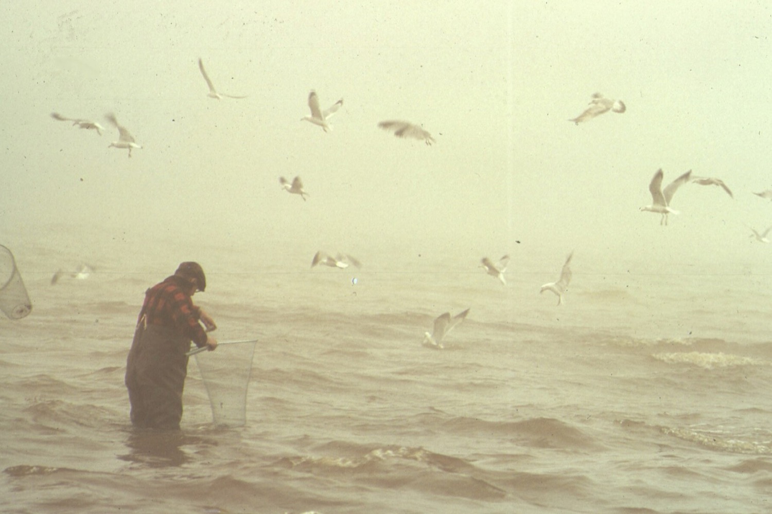
A man in waders and a red plaid shirt stands thigh deep in grey water holding a long handled dip net, with gulls wheeling overhead in thick fog
Dipping for smelt at Tawas City, Michigan, on Lake Huron in April 1973. Smelt run at night in the first weeks after the ice goes out, and the gulls find them as quickly as the people with nets do. “Smelt Run at Tawas City”, Donald Emmerich, DOCUMERICA, U.S. National Archives, Public domain
Sources

Where the Minnesota runs come from

Every month, temperature, place and rule on this page is quoted from these pages, read October 13, 2026. Rules change every year, so check the current regulations before you fish.

Minnesota fish run questions

Advertisement

Runs, months, spawning temperatures, places and rules read October 13, 2026 from the pages listed under sources. Where a state gives no temperature for a species, the figure is the species figure its publisher gives, and the card says so. Water temperatures are the latest reading at a USGS gauge on the run’s own river, fetched when the page opens; a run without one goes by the months.