Yahoo Falls
Rain fedKentucky\u2019s tallest waterfall at 113 feet, with a trail that passes behind it under one of the largest rock shelters in the area.

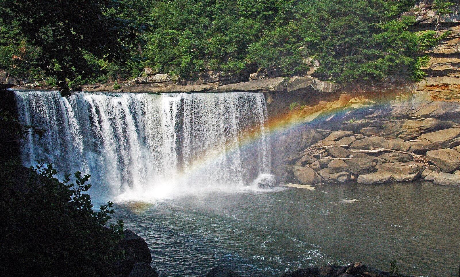
A 125-foot curtain across the Cumberland River, and one of the few places on earth that reliably produces a moonbow.
Trail status, closures and safety rules belong to each falls' managing agency, named and linked on every page.
A big river fall that runs year round and roars in spring. The other calendar here is lunar: the moonbow appears on clear nights around the full moon, which is a schedule the park publishes rather than a weather forecast.
Typical best flow: March through May
Known as the Niagara of the South, the 125-foot curtain of water falling into a boulder-strewn gorge is dramatic day or night. But it is only during a full moon that you can see the moonbow, a phenomenon not found anywhere else in the Western Hemisphere!

Gauge: USGS 03404000 CUMBERLAND RIVER AT WILLIAMSBURG, KY, upstream of the falls. The gauge reads the river, not the brink of the falls, so treat it as the trend line rather than a turnstile.
Source: USGS Water Services (National Water Information System). Instantaneous values and daily statistics services. U.S. Geological Survey data are works of the United States Government and are in the public domain. Gauge verified 2026-08-27.

Overlooks are a short walk from the parking area, with trails to further viewpoints.
Current access and closures: Cumberland Falls State Resort Park (Kentucky State Parks).

Kentucky\u2019s tallest waterfall at 113 feet, with a trail that passes behind it under one of the largest rock shelters in the area.
Make a trip of it
Things to doGuided trips and experiences from local operators.
Browse on Viator Places to stay
Vacation rentals and cabins close to the water.
Browse on VrboWe may earn a commission on bookings made through these links.
Flow windows are typical-year climatology drawn from the driver and the agency language quoted above, not forecasts. Live readings and per-date percentiles are U.S. Geological Survey data, public domain; the above-or-below-typical line is our comparison and is labelled as such. Access, trail and safety information belongs to Cumberland Falls State Resort Park (Kentucky State Parks). National picture: waterfall season across the US →
Hero image: “Cumberland Falls rainbow” by James St. John, CC BY 2.0